By Andrew Hutton (based on work by Will Mitry and Erin Littlewood presented at the 2025 AusIMM LOM Conference, Brisbane.
In an era of rising environmental expectations, regulatory scrutiny, and climate uncertainty, mine closure is no longer a back-end activity. It is a forward-thinking process that must embed resilience, accountability, and nature-positive outcomes from the outset. At the forefront of this transformation are spatial data systems, practical technologies that integrate geographic, environmental, and operational data into intelligent frameworks to support better closure decisions.
That’s why two (2) new spatial intelligence platforms, IMERCS and EcoScenario, developed by staff at IEMA – Integrating Sustainability, Business & Community are gaining momentum. Both are built in Australia, field-tested on operational sites, and developed by mining and closure professionals for mining and closure professionals. Remember “we have walked in your shoes”. Together, they offer a new standard for closure compliance, resilience, and biodiversity performance.
The Shift: Why Spatial Intelligence Matters to mine closure planning
Traditional mine closure systems often rely on disparate data sources, manual workflows, and regional climate assumptions. These legacy approaches struggle to:
- Track evolving closure obligations
- Capture and retain institutional knowledge
- Assess future climate and biodiversity risks
- Demonstrate compliance and performance to regulators
Spatial data systems overcome these limitations by:
- Centralising structured and unstructured environmental data
- Embedding GIS, AI, and automation into operational workflows
- Enabling high-resolution, site-specific modelling
- Supporting transparent, real-time reporting and audit readiness
IMERCS: An Intelligence System for Closure Compliance
IMERCS (Integrated Mining, Environmental, Rehabilitation and Closure System), developed by IEMA in partnership with Whitehaven Coal, is a modular, cloud-based platform built on:
- AWS Cloud Infrastructure – Scalable, secure, and globally deployable
- ESRI ArcGIS – For spatial data integration and visualisation
- OpenAI APIs – To enable AI-driven document interrogation and regulatory reasoning
- FME (Feature Manipulation Engine) – For data automation, transformation, and ingestion across systems
It integrates management plan obligations with execution records, using spatial intelligence, automated workflows, and AI agents to support mine closure and rehabilitation. IMERCS operates on a Plan-Do-Check-Act cycle. IMERCS offers a suite of 13+ configurable modules that can be tailored to site needs. These include:
- Environmental Monitoring: Tracks surface water, groundwater, dust, flora and fauna parameters spatially and temporally
- Rehabilitation Planning and Tracking: Links design with actual performance through drone surveys, NDVI analysis, and milestone tracking
- ePTW (electronic Permit-to-Work): Integrated with spatial constraints and biodiversity overlays
- Cultural Heritage and Subsidence Management: Maps sensitive areas and ensures protection during closure activities
- Closure Cost Estimation: Uses spatial metrics and schedule data to refine provision forecasts
- Regulatory Reporting: Generates automated reports aligned with State and Federal regulations
A standout feature is the AI toolkit embedded in IMERCS:
- IMERCS GPT: Parses management plans, execution records, and survey data to surface compliance status, overdue actions, and misalignments.
- Audit AI: Assists in regulatory audits by extracting and comparing obligation fulfillment across time.
- Regulator GPT: Crosswalks internal documentation with regulatory frameworks to highlight gaps or inconsistencies.
- RehabEye AI (in development): Uses machine learning on drone imagery to assess erosion, vegetation cover, and landform stability.
At Narrabri Coal Operations, IMERCS processed 100+ digital ePTWs without incident, delivered >95% rehab success in key zones, and impressed regulators with its audit readiness.
EcoScenario: Designing for Nature-Positive Closure
Presented at Life of Mine 2025, EcoScenario is IEMA’s GIS-based closure simulation platform. It lets planners model landform and biodiversity performance under future climate conditions, using real site data, not regional proxies. The platform is also being developed to integrate the requirements of mandatory climate reporting into closure planning and can be supported by a detailed climate change risk assessment tailored to site-specific exposures.
EcoScenario is a GIS-based platform that:
- Operates at a 5m x 5m grid resolution for terrain, habitat, and climate inputs
- Utilises IPCC RCP Scenarios (2.6, 4.5, 8.5) to simulate possible climate futures
- Integrates species movement models, fire/flood risk overlays, and hydrological algorithms
- Provides interactive visualisation layers for stakeholder engagement and adaptive design
Core Applications
- Biodiversity Offsets and Connectivity: Models future species corridors, habitat recovery, and edge effects
- Landform Evolution: Simulates erosion, slope stability, and drainage performance under extreme events
- Climate Risk Assessment: Evaluates exposure to cyclones, fire weather, drought stress, and inundation
- Stakeholder Planning: Produces interactive maps and scenario narratives for Traditional Owners, regulators, and communities
Case Studies:
The power of spatial intelligence lies not just in its technical sophistication, but in its practical impact on the ground. IMERCS and EcoScenario have been deployed at active mine sites across diverse geographies and operational contexts, where they are helping closure teams move from static plans to adaptive, data-driven strategies.
The following case studies demonstrate how these platforms can be used to:
- Translate complex closure objectives into spatially targeted actions
- Anticipate environmental risks under future climate scenarios
- Improve regulator confidence through transparent, auditable data
- Deliver measurable ecological outcomes that go beyond compliance
These examples reflect the evolving role of closure professionals—not just as stewards of compliance, but as strategic designers of post-mining landscapes
Hunter Valley, NSW
EcoScenario helped reimagine the post-mining land use from low-productivity grazing to a 570-hectare native woodland corridor, increasing habitat connectivity by 20% and aligning with local biodiversity targets.
North Queensland
Under cyclonic rainfall simulations, EcoScenario identified vulnerabilities in legacy drainage design. Redesign efforts, guided by platform outputs, ensured tailings dam resilience under 1-in-200-year rainfall events
Lessons from the Field: What Makes These Systems Work?
1. Site-Specific Data Over Regional Proxies
Both IMERCS and EcoScenario anchor their intelligence in on-site monitoring and survey data—enabling precise, confident decision-making.
2. Embedded into Operational Workflows
IMERCS integrates seamlessly with daily site operations, connecting rehabilitation teams, planners, and environmental specialists. EcoScenario feeds directly into closure visioning, risk assessments, and community consultation tools.
3. Scalable and Modular Architecture
IMERCS adapts across different operations—from open-cut coal to metalliferous mines—with a plug-and-play module framework. EcoScenario can be calibrated for any terrain, landform objective, or regulatory jurisdiction.
4. AI and Automation
From GPT-powered audits to drone-based landform analytics, the platforms minimise manual effort, maximise insight, and accelerate response times.
Looking Ahead: The Spatial Data Advantage
As mining companies face growing expectations from investors, regulators, communities, and nature itself, the ability to demonstrate closure outcomes will be key to maintaining social license.
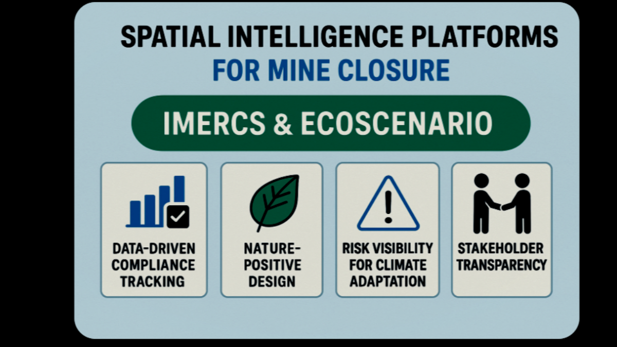
Spatial data systems offer:
- Data-driven compliance tracking and audit readiness
- Nature-positive design that restores ecosystems, not just landform
- Risk visibility for climate adaptation and liability management
- Stakeholder transparency to build trust and accountability
Closing Thoughts: Turning Risk into Readiness
Mine closure is no longer the final chapter; it’s a live process unfolding over decades. The most effective practitioners will be those who can turn complexity into clarity, using tools that speak the language of both regulators and ecosystems.
IMERCS and EcoScenario aren’t just technologies, they’re strategies. They’ve been built with real closure constraints in mind, tested on operational sites, and designed to evolve as the expectations do.
If you’re in the closure game, now is the time to upgrade your toolkit—not just to meet obligations, but to lead the transition to transparent, resilient, nature-positive mining.
Want to see how these tools can work at your site?
Erin Littlewood – Principal Consultant, IEMA [email protected]
Will Mitry – Associate Consultant, IEMA [email protected]